Philadelphia Streets Department Surveys
2755 result(s). Showing results 551 to 600.
View page: 1 2 3 4 5 6 7 8 9 10 11 12 13 14 15 16 17 18 19 20 21 22 23 24 25 26 27 28 29 30 31 32 33 34 35 36 37 38 39 40 41 42 43 44 45 46 47 48 49 50 51 52 53 54 55 56 (Show all on one page)
| Identifer | Preview | Title | Surveyor | Date | Media / Size / Scale | Area / Map Features |
| 144-01 MTD |

|
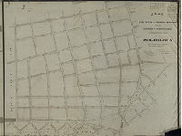
Plan of the First Section of the survey and regulation of Chestnut Hill, Twenty-second Ward, City of Philadelphia. [Resolution, April 28, 1857; approved May 3, 1858; confirmed by Court July 17, 1858] | Lightfoot, Jesse | 1858 |
Mounted
45 x 47 in.
|
Chestnut Hill, 22nd Ward, 1st Section. Bounded by Montgomery County Line to Mermaid La., Germantown Ave. to Union Ave.
Curb elevations, building footprints, "North Branch of Cresheim Creek"
|
| 144-02 MTD |

|
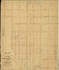
Topography of Plan 144 [Part of Chestnut Hill] | Not named | 1880 ca. |
Mounted
43 x 42 in.
|
Chestnut Hill. Bounded by Gravers La. to Mermaid La., Germantown Ave. to Stenton Ave.
Topography, branch of Cresheim Creek with several dams and ponds, including location of the Chestnut Hill Water Works; building footprints. Streets not named; this plan seems to be a draft showing topography only.
|
| 144-07 MTD |

|
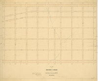
A revision of the lines and grades of City Plan 144. [Ordinance Nov. 10, 1900; confirmed 1906 and 1908] | Wagner, Joseph C. | 1906 |
Mounted
42 x 46 in.
|
Bounded by Germantown Ave., Gravers' Lane, Stenton Ave., Mermaid Lane, Twenty-fifth St. and Willow Grove Ave.
Topography, streams, ponds, railroad and railroad stations
|
| 145-01 MTD tracing |

|
Plan of the First Section of the resurvey and regulation of the late Borough of Germantown, Twenty-second Ward, City of Philadelphia. Ordered by Councils April 17th, 1856. Made under the direction of Jesse Lightfoot. [Approved by Board of Surveyors May 3, 1858] | Lightfoot, Jesse | 1858 |
Tracing
52 x 70 in.
|
22nd Ward, 1st Section, Germantown. Queen St. to Roberts Ave., Washington St. to Germantown Ave.
Streams, roads.
|
| 146-02 MTD |

|
Plan of the survey and regulation of the Eastern Section of the Kensington District of the Northern Liberties, approved by the Board of Commissioners March 26th, 1849. Arranged and revised by Benjn. Moore. | Moore, Benjamin | 1849 |
Mounted
44 x 81 in.
|
Kensington District, Eastern Section. Bounded roughly by Delaware Ave. to Cohocksink Canal, Frankford Ave., Belgrade St. and York St.
Curb elevations, water course, sewers, Gunner's Run [Aramingo] Canal, benchmark bui8ldings, rock at Delaware River front
|
| 146-02 MTD tracing |

|
Plan of the Survey and regulation of the Eastern Section of the Kensington District of the Northern Liberties. Approved by the Board of Commissioners March 26th, 1849. Confirmed by an Act of Assembly passed April 5th, 1849. The same Act requires the confirmation of Franklin Avenue to Richmond St. in the District of Richmond. Arranged and revised by Benjn. Moore. | Moore, Benjamin | 1849 |
Tracing
43 x 82 in.
|
Kensington District, Eastern Section. Bounded roughly by Delaware Ave. to Cohocksink Canal, Frankford Ave., Belgrade St. and York St.
Curb elevations, water course, sewers, Gunner's Run [Aramingo] Canal, benchmark buildings, rock at Delaware River front
|
| 146-17 MTD |

|
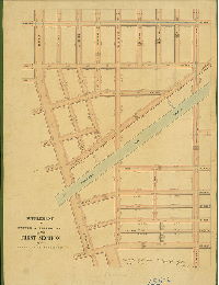
Plan of Penn Treaty Park, 18th Ward, Philadelphia [Ordinance March 10, 1892; confirmed Dec. 19, 1892] | Mercer, Joseph | 1892 |
Mounted
35 x 17 in.
|
Penn Treaty Park, on Delaware River
Park boundaries, Port Warden's Line, wharf
|
| 147-01 HP |

|
Plan of the revision of street and grade lines in the Twenty-Third and Twenty-Fifth Wards Philadelphia in accordance with a resolution of Councils approved October 31st ,1868 [Approved by Board of Surveyors Oct. 17, 1870; confirmed with exceptions by Board, Sept. 2, 1872]. | Not named | 1870 |
Mounted
52 x 93 in.
1 inch = 100 feet
|
Bounded by Richmond St. to Trenton Ave., Kennedy St. to Butler Ave.
Frankford Creek, Aramingo Canal
|
| 147-x HP |

|
Plan of the Fifth Section of the regulations of Frankford, 23rd Ward, Philadelphia [No dates or signatures] | Not named | 1860 ca. |
Mounted
46 x 54 in.
|
Frankford, 5th Section. Bounded by Tucker St., Stiles St., and on two sides by Frankford Creek.
Curb elevations. Plan is unsigned and undated; seems to be an unfinished draft.
|
| 148-x1 HP |

|
Plan of the regulations of Whitehall, 23d Ward Philadelphia. [Ordinance Aug. 15, 1855; approved by Board of Surveyors Nov. 1, 1858; confirmed by Court Dec. 22, 1860] | Shallcross, Isaac (probably) | 1858 |
Mounted
46 x 48 in.
1 inch = 100 feet
|
Whitehall Borough. Frankford Creek to Jackson St. Orthodox St. to seven streets east of Frankford Ave.
Philadelphia and Trenton Railroad, two unnamed creeks, sewers, curb elevations
|
| 148-x2 HP |

|
Plan of the regulations of Whitehall, 23d Ward Philadelphia. [Ordinance Aug. 15, 1855; approved by Board of Surveyors Nov. 1, 1858; confirmed by Court Dec. 22, 1860] | Shallcross, Isaac | 1858. |
Mounted
53 x 43 in.
1 inch = 100 feet
|
Whitehall Borough. Kennedy St. to Orthodox St., Pierce to Walker Sts.
Frankford Creek, Little Tacony Creek, curb elevations, mill pond
|
| 149-01 MTD blueprint |

|
Plan of the Second Section of the survey and regulation of Chestnut Hill, Twenty-second Ward, City of Philadelphia. [Resolution April 28, 1857; approved April 11, 1859] | Lightfoot, Jesse | 1859 |
Blueprint
38 x 57 in.
|
22nd Ward, 2nd Section, Chestnut Hill. Bounded by Gravers La. To Mermaid La., Emlen St. to Germantown Ave.
Curb elevations, streams
|
| 149-06 MTD tracing |

|
A revision of the lines and grades of City Plan 149 bounded by Germantown Avenue, Emlen Street, Mermaid Lane, and Gravers Lane and that portion of City Plan 288 bounded by Emlen St., Cherokee St., Mermaid Lane and Gravers Lane, 22d Ward. Philadelphia. [Ordinance Nov. 10, 1900; confirmed Oct. 1, 1906] | Wagner, Joseph C. | 1906 |
Tracing
42 x 64 in.
|
Chestnut Hill. Bounded by Gravers Lane to Mermaid Lane, Cherokee St. to Germantown Ave.
Topography, streams, pond, railroad
|
| 150-01 CP |

|
Plan of revision of lines and grades of Fifty-fourth Street between Hunter's Lane and Lancaster Av.; also to place Merion Avenue, 55th, 55-1/4, 55-1/2, Oxford and Jefferson Streets on the City Plan [Ordinances 1889 and 1890; Survey returned 1890; confirmed 1890] | Johnson, Joseph | 1890 |
Tracing
18 x 24 in.
|
West Philadelphia. Triangle bounded by Lancaster Ave., Lansdowne Ave. and 56th St.
Curb regulations
|
| 150-01 MTD |

|
Plan of curb regulation of the Seventh Section of the survey of the late Township of Blockley made by direction of a resolution of the Select and Common Councils of the City of Philadelphia approved the eighteenth day of April A.D. 1863. | Smedley, Samuel L. | 1864 |
Mounted
49 x 50 in.
|
West Philadelphia, Blockley Township, 7th Section. Bounded by Wyalusing to Oxford Sts., 48th to 56th Sts.
Mill Creek, mill ponds, mill races
|
| 150-02 MTD tracing |

|
Plan of the revision of the 7th division of the survey and regulation of the late Township of Blockley. [Resolution Dec. 13, 1873; survey returned March 8, 1875; confirmed May 20, 1878] | Hancock, George W. | 1875 |
Tracing
48 x 48 in.
|
West Philadelphia, Blockley, 7th Division. Triangle bounded by Pennsylvania Railroad or Lancaster Ave., 56th St. and Wyalusing Ave.
Topography, Mill Creek, mill races, mill ponds, building footprints, Cathedral Cemetery
|
| 150-06 MTD |

|
Plan of the Seventh Section of the survey of the late Township of Blockley made conformably to the Acts of General Assembly of the Commonwealth of Pennsylvania approved April 3rd, 1851 and May 13th, 1854. Surveyed by contract with the Board of Commissioners by Saml. L. Smedley...returned...6th Mo. 1, 1858. [Approved Feb. 17, 1862; confirmed by Court, May 11, 1862] | Smedley, Samuel L. | 1858 |
Mounted
50 x 50 in.
|
West Philadelphia, Blockley, 7th Section. Bounded by Wyalusing to Oxford Sts, 48th to 56th Sts.
Curb elevations, building footprints, old roads
|
| 150-09 MTD |

|
Plan of Meeting House Lane between Girard Av. & 53rd Street, 24th Ward, as directed by resolution of Council[s] approved April 22, 1873 | Hancock, George W. | 1873 |
Mounted
16 x 19 in.
|
West Philadelphia. Meeting House Lane, between 52nd and 53rd Sts., Wyalusing and Girard Aves.
Meeting House Lane, a diagonal street, "DISAPPROVED"
|
| 151 MTD |

|
Plan of the revision of lines and grades of that portion of Plans Nos. 151 and 152 lying northwest of Kingsessing Ave and between 60th St. and 65th St. 40th Ward Philadelphia. [Ordinance July 7, 1914; confirmed July 19, 1915] | Gillingham, J. Harvey | 1915 |
Mounted
31 x 45 in.
1 inch = 100 feet
|
West Philadelphia. Kingsessing Ave. to Cobb's Creek, 60th St. to 65th St.
Topography, Mt. Moriah Cemetery, building footprints, Cobb's Creek Parkway
|
| 151-01 MTD |

|
Plan of the Second Section of a survey and regulation of Kingsessing. [Act of Assembly May 4, 1857; survey returned 1857; approved by Board of Surveyors Oct. 17, 1870] | Miller, James | 1857 |
Mounted
43 x 53 in.
|
Kingsessing, 2nd Section. Bounded by 53rd to 62nd Streets, Darby Road (Woodland Ave.), Cobbs Creek (Delaware County line) and Thomas Run (Blockley Township line)
Thomas Run, Cobb's Creek, old roads, sewers
|
| 151-02 MTD |

|
Plan of the revision of lines and grades with topography of that portion of the Twenty-seventh Ward, Philadelphia embraced within the limits of Plan No. 151 on file in the Department of Surveys [Ordinance April 2, 1881; confirmed Sept. 29, 1884] | Jones, William H. | 1884 |
Mounted
53 x 44 in.
|
West Philadelphia. Bounded by 62nd St., Cobbs Creek, Florence Ave., 55th St., Willows Ave., 53rd St., and Woodland Ave.
Topography, Ameaseka Creek (Thomas Run) and other streams, old roads, new street confirmations added, building footprints. "Joseph H. Young, topographer and draftsman"
|
| 151-02 MTD tracing |

|
Plan of the revision of lines and grades with topography of that portion of the Twenty-seventh Ward, Philadelphia embraced within the limits of Plan No. 151 on file in the Department of Surveys [Ordinance April 2, 1881; confirmed Sept. 29, 1884] | Jones, William H. | 1884 |
Tracing
54 x 44 in.
|
West Philadelphia. Bounded by 53rd to 62nd Sts., Cobb's Creek, Florence Ave., 55th St. and Willows Ave. to Woodland Ave.
Topography, streams, Thomas Run (Ameaseka Creek), building footprints, property lines, old roads; "Joseph H. Young, Topographer and Draftsman"
|
| 152-03 MTD |

|
Plan of the Third Section of a survey and regulation of Kingsessing made in accordance with a resolution of Councils of the City of Philadelphia approved May 4, 1857. [Surveyed 1857; approved by the Board of Surveyors Oct. 17, 1870] | Miller, James | 1857 |
Mounted
41 x 70 in.
|
Kingsessing, 3rd Section. Bounded by Darby (Woodland) Ave., Cobb's Creek and 62nd St.
Cob's Creek and other streams, old roads, Mt. Moriah Cemetery
|
| 152-04 MTD tracing |

|
Plan of the revision of lines and grades with topography of that portion of the Twenty-seventh Ward Philadelphia embraced within the limits of Plan No. 152 on file in the Department of Surveys. [Ordinance April 2, 1881; survey returned July 1883; confirmed Sept. 29, 1884] | Jones, William H. | 1883 |
Tracing
43 x 72 in.
|
West Philadelphia. Bounded roughly by Cobb's Creek, Woodland Ave., and 62nd St.
Topography, streams, dams, mill races, Mt. Moriah Cemetery, building footprints, old roads
|
| 152-05 MTD |

|
Plan of the revision of the lines and grades of the streets upon Plan No. 152 the lines of which are crossed by the Baltimore and Philadelphia Railroad in the Twenty-seventh Ward, Philadelphia, made in accordance with ordinance of Councils approved July 3rd, 1885. [Survey returned April 1887; confirmed July 18, 1887] | Jones, William H. | 1887 |
Mounted
43 x 72 in.
|
Southwest Philadelphia. Bounded by Woodland Ave., Cobb's Creek, and Cemetery Ave.
Topography, Cobb's Creek, "Passmore Mill Race," dams, Mt. Moriah Cemetery, building footprints, railroad
|
| 152-06 MTD |

|
Plan of the revision of lines and grades on that portion of Plan No. 152 bounded by Greenway Ave., Cobbs Creek, & Seventieth St., 40th Ward [Ordinance March 3, 1901; survey returned May 3, 1901; "Superseded - see minutes of Board of Surveyors, May 2, 1910"] | Gillingham, J. Harvey | 1901 |
Mounted
18 x 21 in.
1 inch = 100 feet
|
Southwest Philadelphia. Bounded by Greenway Ave., Cobbs Creek, and 70th St.
Curb elevations, railroad and bridges, Cobb's Creek and "Passmore's mill race",
|
| 152-07 MTD |

|
Plan of the revision of lines and grades on that portion of Plan No. 152 bounded by Greenway Ave., Cobbs Creek, & Seventieth St., 40th Ward [Ordinance April 4, 1902; survey returned June 1902; confirmed April 6, 1903] | Gillingham, J. Harvey | 1902 |
Mounted
18 x 22 in.
1 inch = 100 feet
|
Southwest Philadelphia. Bounded by Greenway Ave., Cobbs Creek, and 70th St.
Curb elevations, railroad and bridges, Cobb's Creek and mill race
|
| 153-01 HP |

|
Plan of the line and curb regulations of the Twenty-fifth Ward, Fourth Section, City of Philadelphia. [Resolution Nov. 8, 1860; approved by Board of Surveyors Oct. 20, 1862; confirmed by Court May 18, 1863] | Shallcross, Isaac | 1862 |
Mounted
49 x 73 in.
1 inch = 100 feet
|
25th Ward, 4th Section. Bounded by Delaware River to Bath St., Pike St. to Kirkbride St.
Sewers, curb elevations, proposed road sketched in pencil
|
| 154-03 MTD |

|
Plan of the regulations of the 23rd Ward, First Section, Philadelphia. [Resolution Dec. 19, 1857; confirmed by Court May 19, 1862 and Feb. 15, 1871] | Shallcross, Isaac | 1862 ca. |
Mounted
27 x 61 in.
|
23rd Ward, 1st Section. Bounded by Erie to Lehigh Aves., 9th to 16th Sts.
Curb elevations
|
| 154-04 CP |

|
Plan of the [number omitted] section of the revision of lines and grades of the Twenty-fifth Ward Philadelphia [Ordinances 1880 and 1885; confirmed March 15, 1886] | Webster, George S. | 1886 |
Tracing
62 x 29 in.
|
25th Ward. Bounded by 9th St., Lehigh Ave., 11th St., Germantown Ave., and Erie Ave.
Topography, streams, building footprints, old roads
|
| 155-01 HP |

|
Plan of the First Section of the survey and regulation of the District of Richmond agreeably to an Act of the General Assembly of the Commonwealth of Pennsylvania approved the twenty-seventh day of February A.D. 1847. Surveyed and returned 9th mo 12th 1848 by Joseph Fox, Henry Haines. [Attachments: [Plan of] Property transferred to the District of Richmond by the Philadelphia and Reading Railroad Company [1850] and an 1892 letter from Court of Quarter Sessions noting that the plan was confirmed in 1849] | Fox, Joseph; Haines, Henry | 1848 |
Mounted
51 x 37 in.
1 inch = c. 120 feet
|
Richmond District, 1st Section. Bounded by Delaware River to Lemon St., Norris to Williams Sts.
Aramingo Canal, sewers, curb elevations, penciled wharf
|
| 155-02 HP |

|
Plan of the revision of grades made to suit the bridges over Aramingo Canal in part of the First Section of the survey & regulation of the 19th Ward, City of Philadelphia, revised & returned March 3, 1857 by James P. Davis, City Surveyor 6th District | Davis, James P. | 1857 |
Mounted
25 x 31 in.
1 inch = 100 feet
|
19th Ward, 1st Section. Aramingo Canal, York St. to Lehigh Ave., Salmon to Cedar Sts.
Aramingo Canal, sewers, curb elevations
|
| 155-03 HP |

|
Supplement to the survey & regulation of the First Section of the District of Richmond. Made & returned Oct. 4th 1853. | Spain, Edward Livingston | 1853 |
Mounted
26 x 20 in.
1 inch = 100 feet
|
Richmond District, 1st Section. Bounded by Richmond to Cedar Sts., York to Huntingdon Sts.
Aramingo (Gunner's Run) Canal, sewers, curb elevations
|
| 156-01 MTD |

|
Plan of revision of grades of the Second Section of the Twenty-third Ward Philadelphia. [Confirmed 1873 and 1876] | Not named | 1873 |
Mounted
46 x 54 in.
|
23rd Ward, 2nd Section. Bounded by Allegheny to Lehigh Aves., 9th St. to A St.
Curb elevations, sewers, streams, railroad
|
| 156-02 MTD |

|
Plan of the revision of lines and grades of the Second Section in the Twenty-fifth Ward Philadelphia [Ordinances 1870, 1880 and 1885; confirmed 1884, 1885 and 1886] | Not named | 1884 |
Mounted
41 x 54 in.
|
25th Ward, 2nd Section. Bounded by Allegheny to Lehigh Aves., 9th to A Sts.
Topography, streams, railroads, Fairhill Reservoir
|
| 156-03 MTD |

|
Plan of regulations of the Second Section of the 23d Ward Philadelphia. [Approved Jan. 8, 1860; confirmed by Court May 10, 1863] | Not named | 1860 |
Mounted
44 x 50 in.
|
23rd Ward, 2nd Section. Bounded by Allegheny to Lehigh Aves., A St. to 9th St.
Curb elevations, sewers, streams, railroad
|
| 157-01 MTD |

|
Plan of regulations of the Third Section of the 23d Ward Philadelphia. [Resolution Dec. 19, 1857; approved Jan. 3, 1860; confirmed by Court Dec. 22, 1860] | Shallcross, Isaac | 1860 |
Mounted
45 x 50 in.
|
23rd Ward, 3rd Section. Bounded by Erie to Allegheny Aves., 2nd to 11th Sts.
Curb elevations, railroads
|
| 157-02 MTD |

|
Plan of the Third Section of the revision of lines and grades Twenty-fifth Ward (late Twenty-third Ward) Philadelphia. [Ordinances 1880 and 1885; confirmed March 29, 1886] | Webster, George S. | 1886 |
Mounted
39 x 46 in.
|
Bounded by Allegheny to Erie Aves., 11th to 2nd Sts.
Topography, streams, railroad
|
| 158-01 MTD |

|
Plan of regulations of the Fourth Section of the 23d Ward Philadelphia [Resolution Dec. 19, 1857; approved Jan. 3, 1860; confirmed by Court June 11, 1860] | Shallcross, Isaac | 1860 |
Mounted
47 x 53 in.
|
23rd Ward, 4th Section. Bounded by Erie and Allegheny Aves., F St. and 2nd St.
Curb elevations, sewers
|
| 158-02 MTD |

|
Plan of the revision of grades on the Fourth Section of the Twenty-fifth Ward (late Twenty-third Ward) Philadelphia. [Ordinance May 1, 1874; confirmed July 19, 1875.] | Shallcross, Isaac | 1875 |
Mounted
42 x 50 in.
|
25th Ward, 4th Section. Bounded by Delaware River to Bath St., Pike St. to Kirkbride St.
Curb elevations, creek, Connecting Railroad
|
| 158-03 MTD |

|
Plan of the revision of lines and grades upon City Plan No. 158, Thirty-Third Ward Philadelphia [Ordinances 1893 and 1895; confirmed 1896] | Brinton, Walter | 1895 |
Mounted
40 x 50 in.
|
Bounded by Allegheny Ave. to Connecting Railway above Venango St., 2nd St. to F St.
Topography, streams, building footprints, railroad, old roads
|
| 158-05 MTD |

|
Plan of the revision of lines and grades on portion of Plan No. 159 and grades of Venango, Tioga, Westmoreland [and] Ontario Sts., and Allegheny Ave. to avoid crossing at grade with the tracks of the Fairhill Railroad. Thirty-third Ward, Phila. [Ordinance Feb. 27, 1893; surveyed July 17, 1893; confirmation not noted] | Brinton, Walter | 1893 |
Mounted
42 x 35 in.
|
33rd Ward. Bounded by Erie to Allegheny Aves., A St. to F St.
Topography, building footprints, stream, pond. Changes made to remove railroad grade crossings.
|
| 159-01 HP |

|
Plan of the Second Section of the survey and regulation of the District of Richmond agreeably to an Act of the General Assembly of the Commonwealth of Pennsylvania passed the twenty-seventh day of February A.D. 1847. Surveyed and returned 12th mo 31st 1847 By Joseph Fox, Henry Haines [Confirmed June 23, 1848] | Fox, Joseph; Haines, Henry | 1847 |
Mounted
49 x 32 in.
1 inch = 100 feet
|
Richmond District, 2nd Section. Bounded by Norris to Somerset Sts., Jasper to Lemon Sts.
Reading Railroad, Philadelphia and Trenton Railroad, sewers, curb elevations
|
| 160-02 MTD |

|
Plan of the regulations of the Sixth Section of the 23rd Ward, Philadelphia. [Resolution Dec. 19, 1857; approved Jan. 16, 1860; confirmed by Court June 11, 1860] | Shallcross, Isaac | 1860 |
Mounted
53 x 49 in.
|
23rd Ward, 6th Section. Bounded by Erie and Allegheny Aves, Frankford Ave. and F St..
Curb elevations, streams; gradient of the regulated streets also noted
|
| 160-04 MTD |

|
Plan of the Sixth Section of the revision of lines and grades of the Twenty-fifth Ward (late Twenty-third) Philadelphia [Ordinances 1880 and 1885; confirmed 1887, 1888, 1891] | Not named | 1887 |
Mounted
59 x 52 in.
|
25th Ward, 6th Section. Bounded by Erie Ave., Frankford Ave., Allegheny Ave. and F St.
Topography, streams, ponds, old roads
|
| 160-10 FLAT |

|
Plan for placing Harrowgate Park on the City Plan. 25th Ward, Phila. | Brinton, Walter | 1893 |
Mounted
|
Bounded by Kensington Ave., Tioga St., Jasper St. and Kettlewell (Schiller) St.
Stream, building footprints, park
|
| 161-01 MTD |

|
Plan of grade regulations of the Tenth Section of the Township of Blockley [Resolution Feb. 24, 860; approval noted but no date] | Smedley, Samuel L. | 1860 |
Mounted
40 x 47 in.
1 inch = 135 feet
|
West Philadelphia, Blockley, 10th Section. Bounded by Girard to Columbia Aves., 56th to 66th Sts.
Topography, streams, dam and pond
|
| 161-02 MTD |

|
Plan of the Tenth Section of the survey of the late Township of Blockley, made agreeably to two Acts of Assembly of the Commonwealth of Pennsylvania approved respectively on the 3rd of April, A.D. 1851 and the 13th of May A.D. 1856 [Survey returned Dec. 20, 1858; approved by Board of Surveyors Oct. 3, 1859; confirmed by Court Dec. 8, 1859] | Lightfoot, Francis | 1858 |
Mounted
40 x 46 in.
1 inch = 135 feet
|
West Philadelphia, Blockley Township, 10th Section. Bounded by Haverford to Columbia Aves., 56th to 65th Sts.
Property lines and ownership, building footprints, railroad
|
| 163-03 MTD |

|
Plan of the grade regulations and revision of street lines on the Second Division of the Twenty-first now Twenty-eighth Ward of the City of Philadelphia [Resolutions Oct. 1, 1870 and June 24, 1871; confirmed July 19, 1875. Copy made in 1900] | Not named | 1875 |
Mounted
41 x 89 in.
|
21st Ward, 2nd Division. Bounded by Abbotsford Ave. to School House Lane, Schuylkill River to Wissahickon Ave.
Topography, streams, mill ponds, building footprints,
|
| 163-05 MTD |

|
Plan of the re-survey of that part of the Second Division of the Twenty-first Ward which lies northwest of Logan Street continued [Resolution April 17, 1856; approved Feb. 20, 1860; confirmed by Court June 11, 1860] | Siddall, Joseph S. | 1860 |
Mounted
51 x 35 in.
|
28th (late 21st) Ward, 2nd Division. Bounded by Logan St., Township Line Rd. and Schuylkill River
Curb elevations, old roads
|